Pt.6: Maggie Gulch to Little Giant Basin
Course Photographs by Klas Eklof, July 2006
Pt.1 | Pt.2 | Pt.3 | Pt.4 | Pt.5 | Pt.6 |
|
|
Pt.6: Maggie Gulch to Little Giant Basin Course Photographs by Klas Eklof, July 2006 Pt.1 | Pt.2 | Pt.3 | Pt.4 | Pt.5 | Pt.6 | |
|
The last 15 miles.
|
|
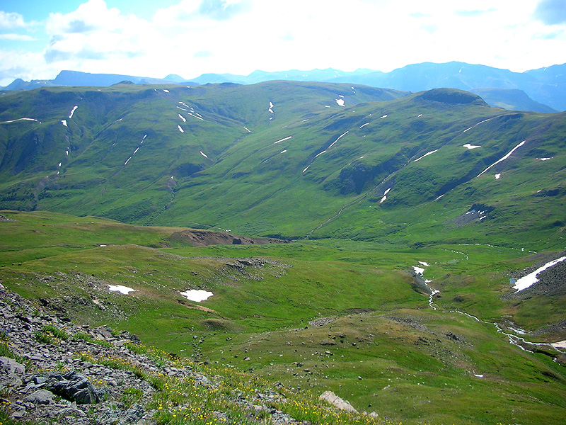
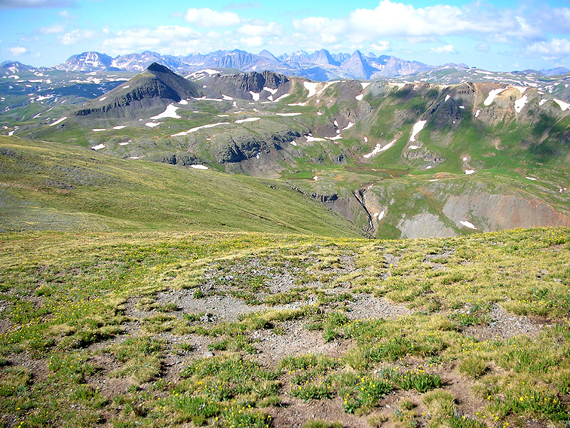
View from the climb from Maggie Gulch to Buffalo Boy Ridge, looking back down to the east.
The location of the Maggie Gulch aid station can be seen far far below, at the end of the road, left-of-center. Maggie-Pole Pass [12,530'] is on the middle-ground ridge, right-of-center. At the extreme upper left is Half Peak [13,841']. |
 |
|
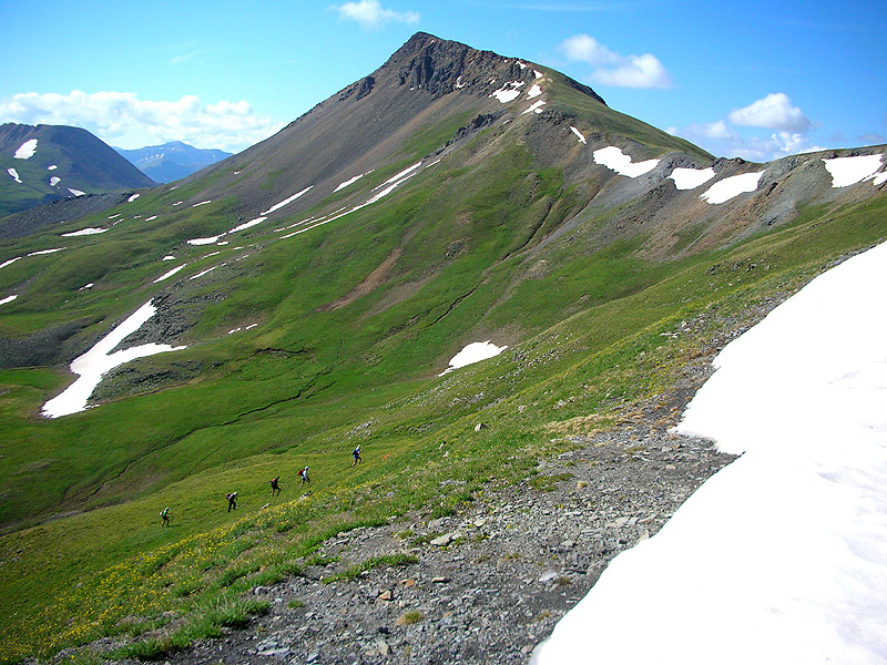
View southeast from the saddle on Buffalo Boy Ridge [13,060'], trail marking party on their way up. Canby Mountain [13,478'] at center. |
 |
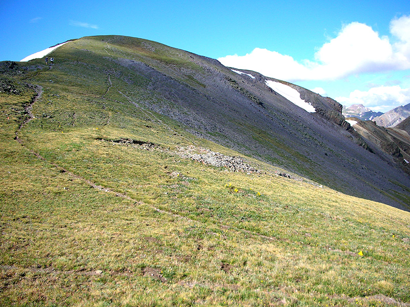
| Still on the saddle on Buffalo Boy Ridge, looking south at the continuation of our trail up the ridge to unnamed peak 13,241'. |
 |
|
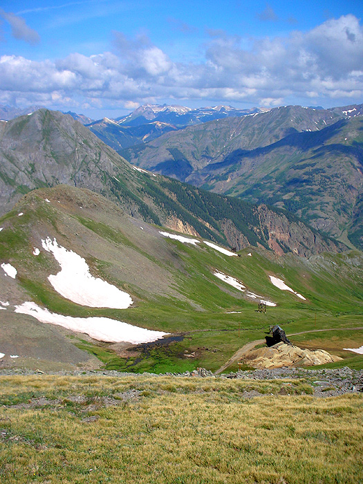
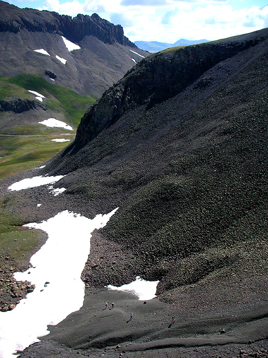
View northwest from Buffalo Boy Ridge, looking down on the remains of the Buffalo Boy Mine. From looking at my topo's I suspect the highest point on the far horizon, left-of-center, is Lookout Peak [13,661'], and immediately behind it is our great climb up Oscar's Pass, only 65 trail miles back. |
 |
|
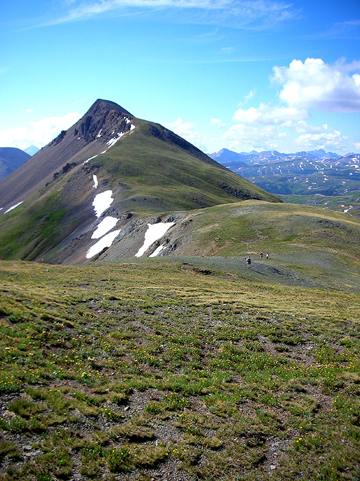
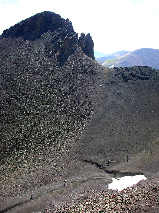
From the top of the unnamed peak 13,241', looking southwest. The middle-ground dark pyramid peak on the left is unnamed point 13,165'. Our trail climbs up the saddle to it's immediate right, Green Mountain Pass [12,580'], see the photos below. Pay no attention to the totally fake mountains in the background, the so-called Grenadier Range. |
 |
|
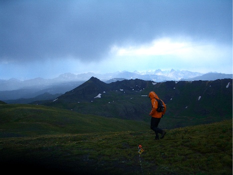
Running at mile 87. This picture is taken of me during the race, by Mark Swanson. This is almost the exact same location and view as my photo above. The electrical storm directly overhead was completely real. I think. |
 |
|
The continuation of our trail southward down Buffalo Boy Ridge from unnamed peak 13,241'. Canby Mountain [13,478'] at left. |
 |
|
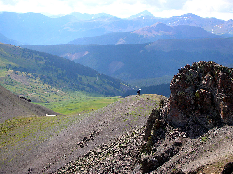
I left the trail to climb Green Mountain and take the following series of photos.
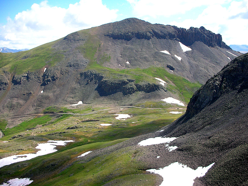
This one is looking east, at the west face of Canby Mountain [13,478']. The grassy saddle at the far left is where our trail began it's descent from Buffalo Boy Ridge. It traversed this face of Canby Mountain, directly above the lower set of cliffs, then crossed Stony Pass where the jeep is parked. |
 |
| Trail marking party on the stony climb from Stony Pass to Green Mountain Pass [12,580']. |
 |
| Ditto. |
 |
|
Two more steps to the top of Green Mountain Pass [12,580']. Road in the Background is Stony Pass to Creede. The highest peak, right-of-center, is the Rio Grande Pyramid. |
 |
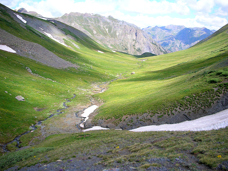
| View into Green Mountain Valley, our trail can be seen continuing across the grassy slope on the far left. It goes all the way down this valley to the little mound in the shadow at the end. |
 |
|
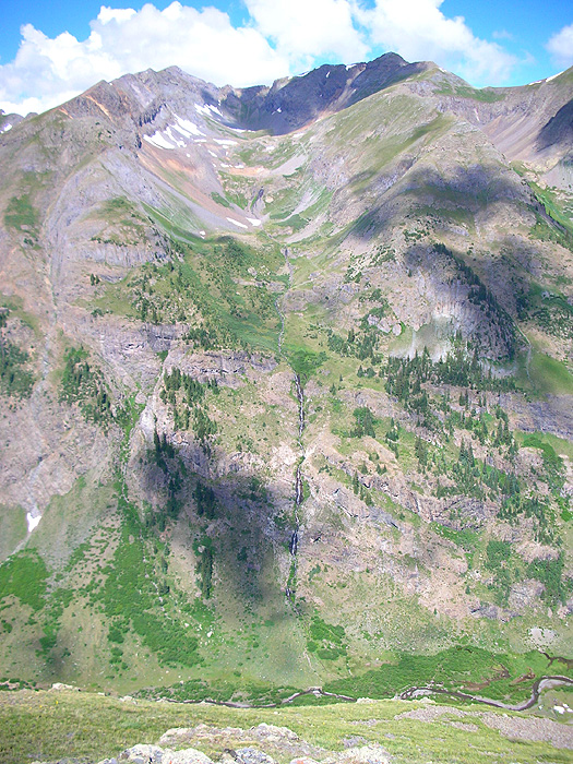
This shot is taken from the little mound, at the north end of Green Mountain Valley,
looking west down into Cunningham Gulch. Cunningham aid station is located next to the river at the very bottom. The descent from here to there is very fast and steep. But most importantly, this view shows the next, and final, climb of the course. The water falling down the opposite cliffs is Dives stream, which is draining Dives Basin. The lowest saddle on the far right side of the horizon is Little Giant Saddle [12,970'] and the finish is all downhill from there. If you look very very closely you can see the 2,600 vertical feet of trail switchbacking up the right side of Dives Basin. |
 |
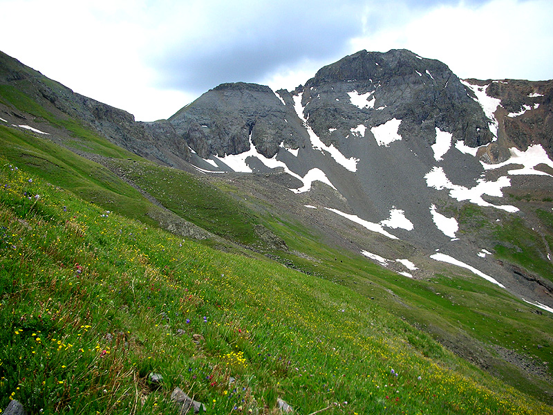
| Now over the last pass, in Little Giant Basin, looking up at Little Giant Saddle [12,970'] on the left, and Little Giant Peak [13,416'] on the right. |
 |
|
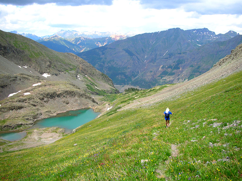
On the descent through Little Giant Basin. To the immediate upper-right of the lake can be seen a dirt road with a truck parked just above a little snow field. Our single-track trail takes us to that road just beyond the truck, from there it's an extremely fast run down through the trees to Arastra Gulch, and then the final 3 miles through the beaver ponds to the finish. |
 |
|
|
Pt.1 |
Pt.2 |
Pt.3 |
Pt.4 |
Pt.5 |
Pt.6 |
Thanks for following along. - Comments, questions, corrections, anything, welcome to klaseklof@earthlink.net - Photo Journal Homepage - Hardrock 100 |